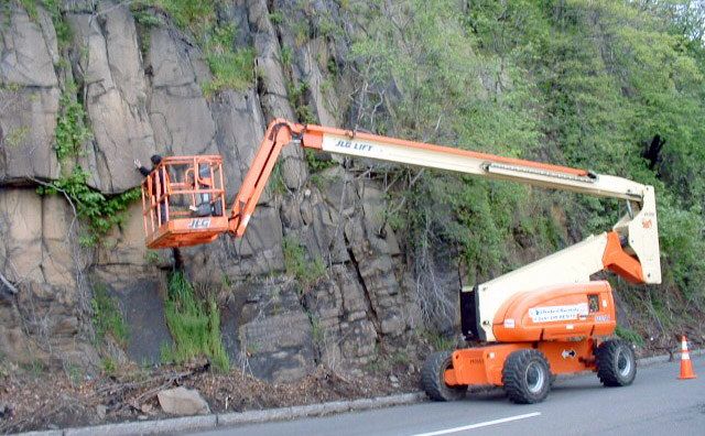
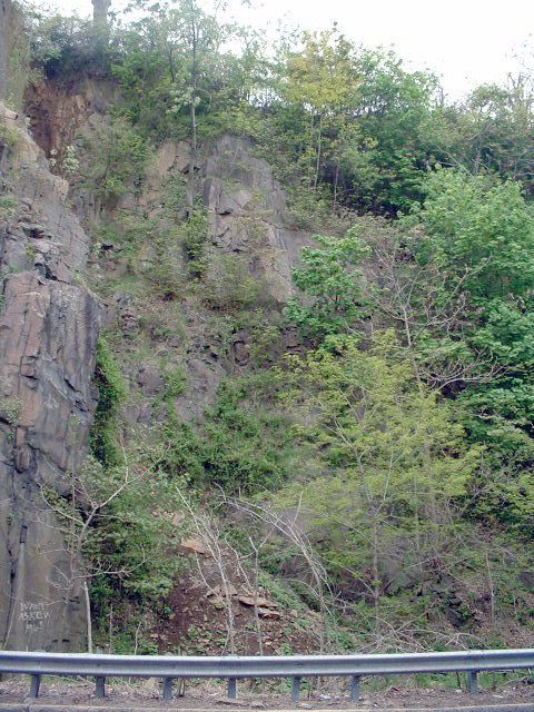
Rock fall was identified as a potential hazard for motorists and pedestrians along the section of Route 5 extending from the top of the Palisades Ridge in Fort Lee to the riverfront low land in Edgewater. The densely vegetated cliff along side the roadway increases from about 15 feet to over 70 feet in height. YU & Associates, Inc. (YU) was retained to inspect and document existing conditions of the cliff, assess the stability of the rock mass and develop remedial measures for rock fall mitigation and/or slope stabilization.
YU planned and directed field investigations including collection of field geological data and identification of potential slope failure mechanisms in the moderately to highly weathered Diabase formation. Among the various potential modes of failure, including raveling, toppling and block failure, and raveling was observed to be the predominant failure mechanism. The recommended stabilization measures included tree and vegetation clearing, mechanical scaling, rock anchors/bolts, shot Crete, and buttressing. Protection methods including double-twist steel netting, catchments ditches and drainage improvements were also recommended for various areas.